Not winter here, not tomorrow

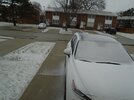
I no longer know what our Wednesday is bringing. On one hand, I see a forecast that is still calling for over 10” of a wintery mix. Watching TV weather last night we’re in an area of unknown precip. Depending on how this thing tracks. Could be rain. Could be ice. Zero mention of snow in my area. The only thing all the “smart” people are saying. It’s gonna be an ugly Wednesday.

So our plans are to have a log ready to go in fireplace. Especially if ice brings down wires and we lose power. We’ll at least stay warm. And then just watch whatever is falling out of the sky.

Everyone stay safe.
 
Wow. North America is filled with pretty colors. Y’all enjoy whatever weathers about to hit you.
1677031512696.png
 
Not looking forward to freezing rain, I would definitely rather have snow...

Freezing Rain Warning​

Issued at 18:16 Tuesday 21 February 2023

Ice storm expected Wednesday.

Hazards:
A prolonged period of freezing rain leading to significant ice build-up in some areas. Ice accretion of 10 to 20 millimetres is possible.
Northeasterly winds gusting 50 to 70 km/h. The strongest wind gusts are expected for exposed areas downwind of Lake Ontario.

Timing:
Wednesday afternoon to early Thursday morning.

Discussion:
Light snow and ice pellets will change over to freezing rain Wednesday afternoon. Freezing rain will continue into Wednesday night before tapering off early Thursday morning to a risk of patchy freezing drizzle. Gusty northeasterly winds will diminish early Thursday morning.

Extensive power outages and tree damage are likely in the worst hit areas.

Another light wintry mix of precipitation is possible Thursday afternoon into Thursday evening.
 
Just starting to get some light snow right now..

Freezing Rain Warning​

Issued at 04:36 Wednesday 22 February 2023

Ice storm beginning this afternoon.

Hazards:
A prolonged period of freezing rain leading to significant ice build-up in some areas. Ice accretion of 10 to 20 millimetres is possible.
Northeasterly winds gusting 50 to 60 km/h.

Timing:
This afternoon to early Thursday morning.

Discussion:
Light snow will become heavy at times and mix with ice pellets early this afternoon. Snow and ice pellets will change over to freezing rain late this afternoon. Freezing rain will continue tonight before tapering off early Thursday morning to patchy freezing drizzle. Gusty northeasterly winds will diminish early Thursday morning.

Extensive utility outages and tree damage are likely due to the combination of ice accretion and moderate winds.

Another light wintry mix of precipitation is possible Thursday afternoon into Thursday evening.
 
Last edited:
I have no idea what we’re gonna get. My app says it’s snowing. I look outside and there ain’t no snow. But it is raining. Temps are right at freezing so at some point it may switch over to freezing rain. Got an Ice Storm warning just west and north of us. Potential for up to a 1/2” of ice. That’s a lot of ice if that happens.
 
Back
Top